
Thring Rock

Back on the Canning
6.00
Up as usual- Wash, breakfast. Check lunch items for a 15 min lunch break. We usually have three Vitawheat biscuits with tinned fish or
some other filling. Fresh fruit if available; otherwise a pot of Two Fruits or peaches. Cup of tea made
from thermos. Yes, its simple and fast. If we had our two fridges with us one would be used for fresh
food, especially fruit and veggies. Our one fridge for this trip is used as a freezer with about 40 frozen
and cryovacced meals for two. Some frozen meat for BBQs as well as the two big beef roasts we are
carrying for the roast night we are preparing. After we leave the CSR we will have eaten most of our
frozen meals and will use it as a fridge and stock fresh produce for the trip home.
7.30
All ready but took more time as group filled up with water from the bore.
8.00
Departed camp site. Another cool sunny morning. Woken at 5am with magnificent trilling for over an
hour by a song bird in a tree beside us. We thought is was a butcher bird. It had a four note Butcherbird
opening call followed by a huge variety of different variations on the trill before it would start a new
song. Terry recorded it on his phone.
8.05
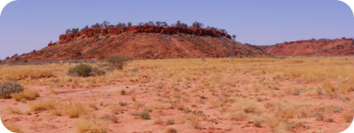
Lovely open plain with Spinifex and flowers; sparse cover of low shrubs. Great features on all sides with
mesa and eroded terraces (Harbutt Range and Cronin Hills) All have a dusting of green on the red sand.
8.25
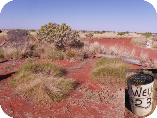
Already half way to Well 23. Road seems good after Talawana Tk.
8.40
Feature ahead called Sleeping Beauty, a mesa that vaguely looks like a reclining woman. Then arrived at
Well 23.
Three speeding rigs passed us while we were at the well. They were Nissans. Their aim was to pass the
group of Mercedes G Class that were being road tested on the CSR and were ahead of us along with a
media circus. They were aiming to get to Wolfe Creek from Well 33 in two nights.
8.45
We departed the well. Meg suspected the hill feature was a ceremony site for the local Aborigines and
probably appeared to them as a figure of a reclining man. A short distance further as we crossed a
claypan with a good view of the feature on our left, a small circular mound of quartz stones was
assembled by the left side of the road. Meg interpreted this as a signal to local Aborigines that the
feature was a ceremony site and only the initiated should approach it.
9.05
A party of nine cars south-bound passed us. We are enjoying the sand and clay pan driving. They told us
they were harshly spoken to by the speeding Nissan drivers probably because they are a large spread
out group, don’t have good radio contact or style and don’t understand they should pull over to let
smaller groups pass – this is track etiquette. They were from NSW and drove an assortment of old cars,
including one pulling a forbidden camper trailer. The first few pulled over and we passed them, then
breasted a sand dune only to find the rest of the group keen to push past us. We let them. All is green
and flowery, a very nice part of the trip.
9.25
Well 24. We almost missed it by going left instead of right. Nice camp site beside it in a valley of 2-3 low
gorges/escarpments. Took photos. Departed Well 24 at 9.35.
Beautiful magenta colored low bushes started to appear. Perhaps a Pimelea? Each flower with 5 petals.
Also saw it on the Talawana Tk and Rudall NP.
9.55
Feature on right horizon. Looked like a sleeping pregnant woman. Any local myths? Were these two
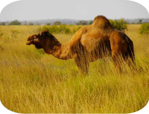
ancestor figures? Herd of camels here too.
10.00
Noticed the optical illusion of a glowing
white line separating land from sky on
the horizon. Saw a single Sturt desert
pea plant. Only one we saw on the CSR.
Drove through particularly beautiful
flower meadows in the swales between
several dunes. Yellow, purple, pink and magenta flowers abounded.
Noticed that the morning light creates only two tones for all the flower colors and greens ie dark & 1
light. Shrubs have dark bases and highlites are very lite.
10.25
Took a sidetrack to avoid a very bright pink lake. Not named on map. Sand also was a deep opaque
pink. It was quite large and full and we travelled along its edge for a way.
10.40
Stopped for morning tea by pink lake. Cold outside with a strong wind that was churning the surface of
the lake , we donned our cosies and gloves . The sunshine created unusual orange high lites on the
waves. Well 24 is also called Curara Soaks and we suspect it must be connected to this pink lake along a
basin depression that extends these many kms. Recent rains must have filled this depression. We
concluded that well 25 was under water, also connected to the pink lake depression as it was not visible
under the water as we passed where it should have been on the map.
11.00
Floral gardens are also appearing along the swales beyween these sand dunes as the track takes us along these swales. Beautiful blue/grey
cushion bushes, maybe 30cm high; yellow/lime green spinifex cushions about the same size and red sand. Ana a yellowy green shrub.
Beautiful color combination!
11.15
Now approaching groups of 4-5 sand dunes including a “bucking bronco” - what a rough ride!
11.20
Over the dunes and traversing a wide Spinifex plain.
11.25
“The snake” an S-shaped sand dune – but OK to cross.
11.40
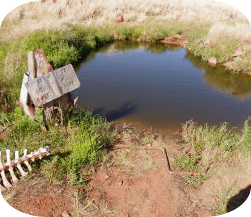
Arrived well 26 (See picture at top of page). This one is fully restored to historical specifications. It is the
only one on the CSR that fully shows how they were set up to spin water up the well in buckets and drop
it into the shute leading to the long trough from which the animals drank. This was restored in 1983 by a
team of 25 who completed it in eight days. Led by David Hewitt who was supervisor of Aboriginal
Housing. An engineer and architect were also part of the team. His daughter Heather had the Heather
Hwy named after her. Bet she hasn’t travelled on it recently! We took photos and enjoyed this example of
historic restoration as the other abandoned and ruined wells gave no accurate impression of how they
were meant to work. The odd bits of rusted metal and wire and wormy wood that we saw elsewhere now
could be related to the reconstruction.
12.13
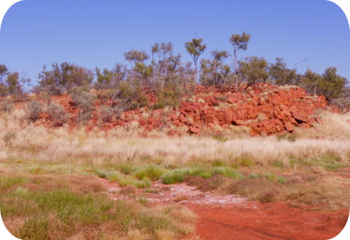
Slate Range appeared on our right. One mesa and a long terrace appeared – dark colored – maybe
ironstone?? Or dark red slate? East/west lines of sand dunes ran across the CSR up to the range. In
between the dunes were Spinifex planes.
12.20
Continue to drive along the Slate Range running N/S along side us. Fabulous views: its coppery tones and
blue/grey foliage of shrubs on its fans looked great. Carpets of purple and yellow flowers on the dunes below.
12.3
Stopped at lookout hill with small white stipes on its sides: quartzite laterite? We didn’t drive up the hill.
12.35
Starting to see the Red Dune Grevillea again, a white flower on the red sand hills.
12.40
Single car travelling south passed us and warned us to look out for a lone cyclist on a push bike just north of well 28. What? Out here? We
assumed he had a backup car. Stopped here for lunch. Departed lunch spot 1.08. We are still seeing the charming “snowdrops”, tiny stems
of white flowers in clumps and maybe 15-20 cm high.
1.20
Well 27. Reputedly a brown snake lives in the well. Lots of finches round well and a stand of melaleuca trees nicely grown and about 30 ft
high. A native soak nearby supplies water to the birds. An important Aboriginal cultutal site is nearby: maybe Mt Helen? A nipple shaped
mesa.
2.00
Passing Spinifex plumes waving in breeze and glinting a silver/gold in the sunlight. Could use a metallic pen for this effect.
2.10.
Passed the Lone cyclist. Amazing. No backup car – just him. He was a young Dutchman and carried very little on his bike that we could
see. Kay asked him if he needed to restock with food or water as we could give him supplies, he politely declined. He had been on the road
travelling south for two and half weeks. Annie took a photo.
Have been traversing lots of sand dunes since lunch time. Quite constant.
2,35
Arrived well 28. One ruined hole in the ground all else destroyed by fire and time. Melaleuca scrub around it. Departed well 2.40.
3.50
Arrived well 29. Departed immediately Geoff proposed we should divert onto the track up to Thring Rock which was about 1km up the road.
He had information that there was good camping on that track. We all agreed and turned into the mulga scrub. Very cold night Strong east
wind. We stopped at the first open space, but next day discovered a more sheltered site about 2-3 km up the road sheltered by trees.


Thu 4th August : 182Km
53 sand dunes


26
26


Thring Rock

Back on the Canning
6.00
Up as usual- Wash, breakfast. Check lunch
items for a 15 min lunch break. We usually
have three Vitawheat biscuits with tinned
fish or some other filling. Fresh fruit if
available; otherwise a pot of Two Fruits or
peaches. Cup of tea made from thermos.
Yes, its simple and fast. If we had our two
fridges with us one would be used for fresh
food, especially fruit and veggies. Our one
fridge for this trip is used as a freezer with
about 40 frozen and cryovacced meals for
two. Some frozen meat for BBQs as well as
the two big beef roasts we are carrying for
the roast night we are preparing. After we
leave the CSR we will have eaten most of
our frozen meals and will use it as a fridge
and stock fresh produce for the trip home.
7.30
All ready but took more time as group filled
up with water from the bore.
8.00
Departed camp site. Another cool sunny
morning. Woken at 5am with magnificent
trilling for over an hour by a song bird in a
tree beside us. We thought is was a butcher
bird. It had a four note Butcherbird opening
call followed by a huge variety of different
variations on the trill before it would start a
new song. Terry recorded it on his phone.
8.05
Lovely open plain with Spinifex and flowers;
sparse cover of low shrubs. Great features
on all sides with mesa and eroded terraces
(Harbutt Range and Cronin Hills) All have a
dusting of green on the red sand.
8.25
Already half way to Well 23. Road seems
good after Talawana Tk.
8.40
Feature ahead called Sleeping Beauty, a mesa that vaguely looks
like a reclining woman. Then arrived at Well 23.
Three speeding rigs passed us while we were at the well. They
were Nissans. Their aim was to pass the group of Mercedes G
Class that were being road tested on the CSR and were ahead of
us along with a media circus. They were aiming to get to Wolfe
Creek from Well 33 in two nights.
8.45
We departed the well. Meg suspected the hill feature was a
ceremony site for the local Aborigines and probably appeared to
them as a figure of a reclining man. A short distance further as
we crossed a claypan with a good view of the feature on our left,
a small circular mound of quartz stones was assembled by the
left side of the road. Meg interpreted this as a signal to local
Aborigines that the feature was a ceremony site and only the
initiated should approach it.
9.05
A party of nine cars south-bound passed us. We are enjoying the
sand and clay pan driving. They told us they were harshly spoken
to by the speeding Nissan drivers probably because they are a
large spread out group, don’t have good radio contact or style
and don’t understand they should pull over to let smaller groups
pass – this is track etiquette. They were from NSW and drove an
assortment of old cars, including one pulling a forbidden camper
trailer. The first few pulled over and we passed them, then
breasted a sand dune only to find the rest of the group keen to
push past us. We let them. All is green and flowery, a very nice
part of the trip.
9.25
Well 24. We almost missed it by going left instead of right. Nice
camp site beside it in a valley of 2-3 low gorges/escarpments.
Took photos. Departed Well 24 at 9.35.
Beautiful magenta colored low bushes started to appear. Perhaps
a Pimelea? Each flower with 5 petals. Also saw it on the Talawana
Tk and Rudall NP.
9.55
Feature on right horizon. Looked like a sleeping pregnant woman.
Any local myths? Were these two ancestor figures? Herd of
camels here too.
10.00
Noticed the optical illusion of a glowing white line separating land
from sky on the horizon. Saw a single Sturt desert pea plant.
Only one we saw on the CSR.
Drove through particularly beautiful flower meadows in the
swales between several dunes. Yellow, purple, pink and magenta
flowers abounded.
Noticed that the morning light creates only two tones for all the
flower colors and greens ie dark & 1 light. Shrubs have dark
bases and highlites are very lite.
10.25
Took a sidetrack to avoid a very bright pink lake. Not named on
map. Sand also was a deep opaque pink. It was quite large and
full and we travelled along its edge for a way.
10.40
Stopped for morning tea by pink lake. Cold outside with a strong
wind that was churning the surface of the lake , we donned our
cosies and gloves . The sunshine created unusual orange high
lites on the waves. Well 24 is also called Curara Soaks and we
suspect it must be connected to this pink lake along a basin
depression that extends these many kms. Recent rains must
have filled this depression. We concluded that well 25 was under
water, also connected to the pink lake depression as it was not
visible under the water as we passed where it should have been
on the map.
11.00
Floral gardens are also appearing along the swales beyween
these sand dunes as the track takes us along these swales.
Beautiful blue/grey cushion bushes, maybe 30cm high;
yellow/lime green spinifex cushions about the same size and red
sand. Ana a yellowy green shrub. Beautiful color combination!
11.15
Now approaching groups of 4-5 sand dunes including a “bucking
bronco” - what a rough ride!
11.20
Over the dunes and traversing a wide Spinifex plain.
11.25
“The snake” an S-shaped sand dune – but OK to
cross.
11.40
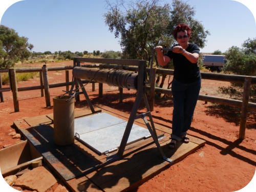
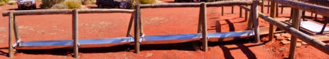
Arrived well 26 (See picture at top of page). This
one is fully restored to historical specifications. It
is the only one on the CSR that fully shows how
they were set up to spin water up the well in
buckets and drop it into the shute leading to the
long trough from which the animals drank. This was restored in
1983 by a team of 25 who completed it in eight days. Led by
David Hewitt who was supervisor of Aboriginal Housing. An
engineer and architect were also part of the team. His daughter
Heather had the Heather Hwy named after her. Bet she hasn’t
travelled on it recently! We took photos and enjoyed this example
of historic restoration as the other abandoned and ruined wells
gave no accurate impression of how they were meant to work.
The odd bits of rusted metal and wire and wormy wood that we
saw elsewhere now could be related to the reconstruction.
12.13
Slate Range appeared on our right. One mesa and a long terrace
appeared – dark colored – maybe ironstone?? Or dark red slate?
East/west lines of sand dunes ran across the CSR up to the
range. In between the dunes were Spinifex planes.
12.20
Continue to drive along the Slate Range running N/S along side
us. Fabulous views: its coppery tones and blue/grey foliage of
shrubs on its fans looked great. Carpets of purple and yellow
flowers on the dunes below.
12.3
Stopped at lookout hill with small white stipes on its sides:
quartzite laterite? We didn’t drive up the hill.
12.35
Starting to see the Red Dune Grevillea again, a white flower on
the red sand hills.
12.40
Single car travelling south passed us and warned us to look out
for a lone cyclist on a push bike just north of well 28. What? Out
here? We assumed he had a backup car. Stopped here for lunch.
Departed lunch spot 1.08. We are still seeing the charming
“snowdrops”, tiny stems of white flowers in clumps and maybe
15-20 cm high.
1.20
Well 27. Reputedly a brown snake lives in the well. Lots of finches
round well and a stand of melaleuca trees nicely grown and about
30 ft high. A native soak nearby supplies water to the birds. An
important Aboriginal cultutal site is nearby: maybe Mt Helen? A
nipple shaped mesa.
2.00
Passing Spinifex plumes waving in breeze and glinting a
silver/gold in the sunlight. Could use a metallic pen for this
effect.
2.10.
Passed the Lone cyclist. Amazing. No backup car – just him. He
was a young Dutchman and carried very little on his bike that we
could see. Kay asked him if he needed to restock with food or
water as we could give him supplies, he politely declined. He had
been on the road travelling south for two and half weeks. Annie
took a photo.
Have been traversing lots of sand dunes since lunch time. Quite
constant.
2,35
Arrived well 28. One ruined hole in the ground all else destroyed
by fire and time. Melaleuca scrub around it. Departed well 2.40.
3.50
Arrived well 29. Departed immediately Geoff proposed we should
divert onto the track up to Thring Rock which was about 1km up
the road. He had information that there was good camping on
that track. We all agreed and turned into the mulga scrub. Very
cold night Strong east wind. We stopped at the first open space,
but next day discovered a more sheltered site about 2-3 km up
the road sheltered by trees.


26


