Tobin Lake


Sun 7th August : 180Km
96 sand dunes
Tobin Lake, Tobins Grave, Lake Guli
8.10
Departure. We quickly reached the edge of Lake Tobin about 4Km away. It's unsheltered but the surface is good
for emergency camping if needed as there is no spinfex. The previous afternoon had drawn very few sites for
our five cars as there was a constant ground cover of spinifex. Our previous nite sight was far more
comfortable. Lake Tobin doesn't look like a salt lake. Its covered in low grass, not white salt or salt bush. Some
lone trees on the n. side. Tobin is part of the larger Percival Lakes system.
Museum Victoria organized a large archealogical dig on one of the other lakes in this system. They were looking
for evidence of early settlement by Aboriginal people similar to that found at Lake Mungo in NSW, which
discovered Mungo man and later Mungo woman, the male skeleton being about 40,000 years old. Lake Tobin (if
similar to the other lakes in the Percival system) is similar in some respects to Lake Mungo. Its wide and
shallow with lunettes formed on the lake sides relevant to the prevailing winds. They are set in a low basin and
either would have been joined up or formed over a large area over 150km in length, currently in a wide arc.
Tens of thousands of years ago they would have been a fresh water system and still may be when filled as they
grow grass and not saltbush.
8.20
Stopped near edge of Lake Tobin. Met two vehicles travelling south.
8,50
Well 40 (Waddawalla well) At a T intersection there is sheltered meleleuca scrub to the right with enough room
for five vehicles to camp, a good night site. To the left, is the well and grave of Michael Tobin, a member of
Cannings 1907 survey party who was speared by an Aborigine on their way back south. He was in advance
position and allegedly had taken a young Aboriginal woman into his camp for several nights. Her husband came
and speared him in the chest, while he grabbed a gun and shot his attacker. The main party found both bodies
when they arrived. They were buried in separate areas near the well. This appears to be a nineteenth century
custom in the bush. White fellas are buried away from Aborigines, Chinese or Afghans. The Lands Department,
who was the employer constructed an elaborate grave with an inscribed marble and tin grave stone above
Tobins grave. Wooden rails that were restored a few years ago have disappeared eaten by white ants. The
reason for his killing became known much later when a local Aboriginal woman told the story.
9.10
Departed well 40 after visiting Tobins grave. Found flowers on the grave.
Driving through red sandhills in the swales between the dunes Low spinifex scub, tinsel bush and sparse tree cover on dunes. The general
terrain consists of East/West dunes that we climb over, with open spinifex plains inbetween. We are making good time in this country.
9.35
Have done 34 km so far. Good.
9.45
Driving through narrow avenues of 20m high scrub. Side mirrors are in and lots of scratches.
9.58
Seismic cut line running along a swale in between dunes. Barely visible as we crossed it due to vigorous
regrowth of low vegetation. Steels posts on either side of the track mark it as we cross it.
10.05
Well 41 (Tiri well) Looks like the previous haunted well: white clay dirt, lots of white trunks of dead trees
around the area. The well has been restored by teams hauling in the materials from Halls Creek to the north.
Must have been rugged getting it over the dunes. This restoration appears to have been recent (last 10 years?)
Departed well at 10.30.
H.V. (Bill) Johnson put in a new track between wells 41 - 42 in the 1960s and picked the path over the highest
dunes from which he read his trig points. We expect to climb the highest dunes on the CSR today in this area.
11.20
So far the dunes have been similar in height to those we crossed yesterday. Nothing has stood out as more
difficult. Our cars are having no trouble climbing the dunes although the Nissan has found them very bumpy.
We have had to retry two dunes to get over. In both cases Terry was trying out a higher gear.
11.25
Stick caught in side top rail on roof rack. Stopped to remove it.The track weaves in and out of the low scrub. Was the track maker drunk?
11.50
We drove over the CSR highest dune. Quite easy to drive over. Not sure how high it was a sit is difficult to determine where it starts.
Probably round 150 mts. High. One of yesterday's dune was a amore difficult climb. Others in the party said some dunes on the Simpson
Desert trip were higher and more difficult.
12.00
In more open plains now with low scrub. Some trees on dunes.
12.10
Met three south bound vehicles on a sand dune. They pulled over in the middle of one dune. Despite radio
chatter its difficult to assume that everyone on the track understands track "give way" etiquette and safety.
12.30
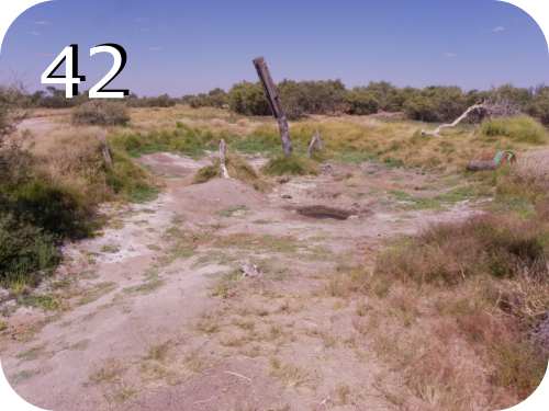
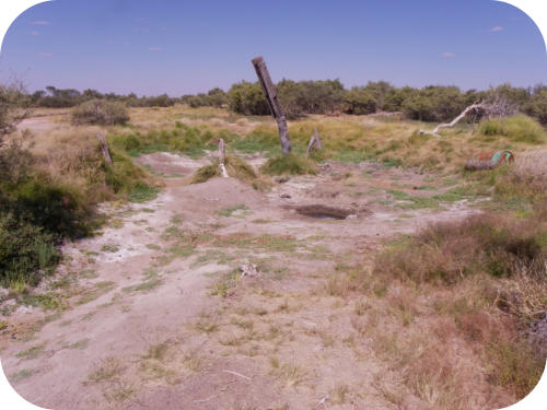
Arrived well 42. (Guli well) This is an abandoned well. Only a hole in the ground left in the white clay. Water
was available in it and it was a good source for birds. Departed 12.40.
12.40
Crossed Lake Guli. Low scrub cover on it, no shade, lunettes on the N. side.
12.48
Still seeing purple tinsel bush for most of the day on the track.
12.55
Lunch stop. We all clustered in the shade of one tree; it was around 32c. and very warm. Departed at 1.25. Corregations got very bad
quite quickly.
2.00
Well 43 (Billowaggi well). A small salt lake with melaleaca scrub, pig face and a dried out well. All dusty but you could camp here with trees
for wind break. Dave has been radioing ahead to other groups to check where people are camping and news of good sites. Sounds as if
another group is camping beyond this well in the spot we expected to use. This is of great interest to Meg as she is cooking the roast for 10
tonight and asked for an early camp around 3.30pm. She is also quite anxious about it. Time is needed to get coals going and for the
cooking time. Also there is very little wood available on the track on this part of the CSR. Departed well at 2.05.
2.30
We met 5-6 cars cars from an Adelaide club camped in the dunes where we expected to be. Oh well! Onwards. We will head for the next
well about 30 km on.
3.30
Still no camping spots. Spinifex everywhere. Have seen spots for 1 or 2 cars but not for 5. Now collecting firewood and its hard to get!.
5.15
Finally arrived at a camp site. Had to rush to get dinner ready. Boys got the fire going and ladies helped get meal ready. Kay did mardarin
pancakes for desert. Ate at 7.15 and roast beef was great. Meg was mightyly relieved and started to relax.


Tobin Lake

Tobin Lake, Tobins Grave, Lake Guli
8.10
Departure. We quickly reached the edge of Lake Tobin about 4Km
away. It's unsheltered but the surface is good for emergency
camping if needed as there is no spinfex. The previous afternoon
had drawn very few sites for our five cars as there was a constant
ground cover of spinifex. Our previous nite sight was far more
comfortable. Lake Tobin doesn't look like a salt lake. Its covered in
low grass, not white salt or salt bush. Some lone trees on the n.
side. Tobin is part of the larger Percival Lakes system.
Museum Victoria organized a large archealogical dig on one of the
other lakes in this system. They were looking for evidence of early
settlement by Aboriginal people similar to that found at Lake
Mungo in NSW, which discovered Mungo man and later Mungo
woman, the male skeleton being about 40,000 years old. Lake
Tobin (if similar to the other lakes in the Percival system) is similar
in some respects to Lake Mungo. Its wide and shallow with
lunettes formed on the lake sides relevant to the prevailing winds.
They are set in a low basin and either would have been joined up
or formed over a large area over 150km in length, currently in a
wide arc. Tens of thousands of years ago they would have been a
fresh water system and still may be when filled as they grow grass
and not saltbush.
8.20
Stopped near edge of Lake Tobin. Met two vehicles travelling
south.
8,50
Well 40 (Waddawalla well) At a T intersection there is sheltered
meleleuca scrub to the right with enough room for five vehicles to
camp, a good night site. To the left, is the well and grave of
Michael Tobin, a member of Cannings 1907 survey party who was
speared by an Aborigine on their way back south. He was in
advance position and allegedly had taken a young Aboriginal
woman into his camp for several nights. Her husband came and
speared him in the chest, while he grabbed a gun and shot his
attacker. The main party found both bodies when they arrived.
They were buried in separate areas near the well. This appears to
be a nineteenth century custom in the bush. White fellas are
buried away from Aborigines, Chinese or Afghans. The Lands
Department, who was the employer constructed an elaborate
grave with an inscribed marble and tin grave stone above Tobins
grave. Wooden rails that were restored a few years ago have
disappeared eaten by white ants. The reason for his killing
became known much later when a local Aboriginal woman told the
story.
9.10
Departed well 40 after visiting Tobins grave. Found flowers on the
grave.
Driving through red sandhills in the swales between the dunes
Low spinifex scub, tinsel bush and sparse tree cover on dunes.
The general terrain consists of East/West dunes that we climb
over, with open spinifex plains inbetween. We are making good
time in this country.
9.35
Have done 34 km so far. Good.
9.45
Driving through narrow avenues of 20m high scrub. Side mirrors
are in and lots of scratches.
9.58
Seismic cut line running along a swale in between dunes. Barely
visible as we crossed it due to vigorous regrowth of low
vegetation. Steels posts on either side of the track mark it as we
cross it.
10.05
Well 41 (Tiri well) Looks like the previous haunted well: white clay
dirt, lots of white trunks of dead trees around the area. The well
has been restored by teams hauling in the materials from Halls
Creek to the north. Must have been rugged getting it over the
dunes. This restoration appears to have been recent (last 10
years?) Departed well at 10.30.
H.V. (Bill) Johnson put in a new track between wells 41 - 42 in the
1960s and picked the path over the highest dunes from which he
read his trig points. We expect to climb the highest dunes on the
CSR today in this area.
11.20
So far the dunes have been similar in height to those we crossed
yesterday. Nothing has stood out as more difficult. Our cars are
having no trouble climbing the dunes although the Nissan has
found them very bumpy. We have had to retry two dunes to get
over. In both cases Terry was trying out a higher gear.
11.25
Stick caught in side top rail on roof rack. Stopped to remove it.The
track weaves in and out of the low scrub. Was the track maker
drunk?
11.50
We drove over the CSR highest dune. Quite easy to drive over. Not
sure how high it was a sit is difficult to determine where it starts.
Probably round 150 mts. High. One of yesterday's dune was a
amore difficult climb. Others in the party said some dunes on the
Simpson Desert trip were higher and more difficult.
12.00
In more open plains now with low scrub. Some trees on dunes.
12.10
Met three south bound vehicles on a sand dune. They pulled over
in the middle of one dune. Despite radio chatter its difficult to
assume that everyone on the track understands track "give way"
etiquette and safety.
12.30
Arrived well 42. (Guli well) This is
an abandoned well. Only a hole in
the ground left in the white clay.
Water was available in it and it was
a good source for birds. Departed
12.40.
12.40
Crossed Lake Guli. Low scrub cover
on it, no shade, lunettes on the N.
side.
12.48
Still seeing purple tinsel bush for most of the day on the track.
12.55
Lunch stop. We all clustered in the shade of one tree; it was
around 32c. and very warm. Departed at 1.25. Corregations got
very bad quite quickly.
2.00
Well 43 (Billowaggi well). A small salt lake with melaleaca scrub,
pig face and a dried out well. All dusty but you could camp here
with trees for wind break. Dave has been radioing ahead to other
groups to check where people are camping and news of good
sites. Sounds as if another group is camping beyond this well in
the spot we expected to use. This is of great interest to Meg as
she is cooking the roast for 10 tonight and asked for an early
camp around 3.30pm. She is also quite anxious about it. Time is
needed to get coals going and for the cooking time. Also there is
very little wood available on the track on this part of the CSR.
Departed well at 2.05.
2.30
We met 5-6 cars cars from an Adelaide club camped in the dunes
where we expected to be. Oh well! Onwards. We will head for the
next well about 30 km on.
3.30
Still no camping spots. Spinifex everywhere. Have seen spots for 1
or 2 cars but not for 5. Now collecting firewood and its hard to
get!.
5.15
Finally arrived at a camp site. Had to rush to get dinner ready.
Boys got the fire going and ladies helped get meal ready. Kay did
mardarin pancakes for desert. Ate at 7.15 and roast beef was
great. Meg was mightyly relieved and started to relax.